
Walk a Kansas City Street
A sound street search is a chain, not a single hit. Begin with the complete postal address, then use Unified Government records to pin it to a parcel. An owner label does not prove who lives there. The parcel and legal description are the durable keys that connect a current tax record to plats and filed instruments.
- Verify the complete delivery address with USPS. Save its last-line city and ZIP.
- Search the Unified Government Appraiser. Copy the Quick Ref ID, parcel ID, situs, mailing address, legal description, map number, and book/page.
- Compare GSS property-address and parcel layers. Open parcel, quarter-section, plat, and engineering maps.
- Ask the Register of Deeds for the instrument by legal description or book/page.
- Use directories, newspapers, or voter routes only for the question and date each source supports.
Repeat the same steps for each parcel on the block. Keep owner, occupant, mailing contact, and historical resident in separate fields.
Kansas City Address Search Fields
The Appraiser supports Property Search and Advanced Search. County material identifies name, address, Quick Ref ID, Clerk ID, Parcel, and KUPN as possible identifiers. A detail card then exposes the fields that make a street directory result reproducible.
| Field | Use | Limit |
|---|---|---|
| Address | Find the current situs | Units and directionals affect matches |
| Quick Ref / Parcel | Distinguish the tax parcel | Not a person identifier |
| Owner / mailing | Show tax label and contact address | Neither proves occupancy |
| Legal description | Connect lot, block, subdivision, deeds | Verify against an instrument |
| Book/page / map | Point to a filing or sheet | Not the underlying image |
The live Appraiser search screen is the official starting point.
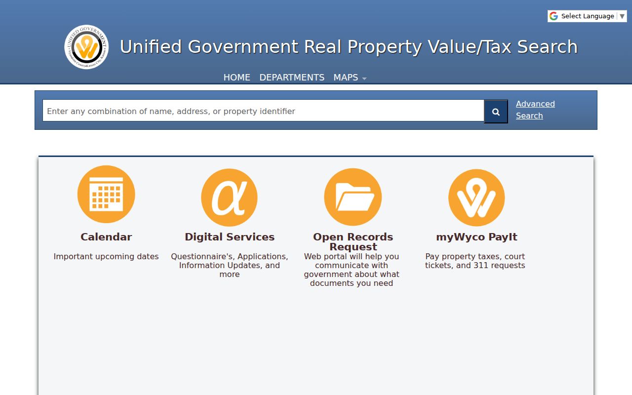
Its result should be treated as an index into a dated property card, not a roster of everyone on a street.
Read Kansas City Parcel Cards
The R22714 sample displays an owner label, situs, identifiers, legal description, neighborhood, taxing unit, book/page, mapped acreage, and tax-year value. Those fields establish a tax snapshot. They do not establish that the owner resides at the property.
Inspect sample parcel R22714.
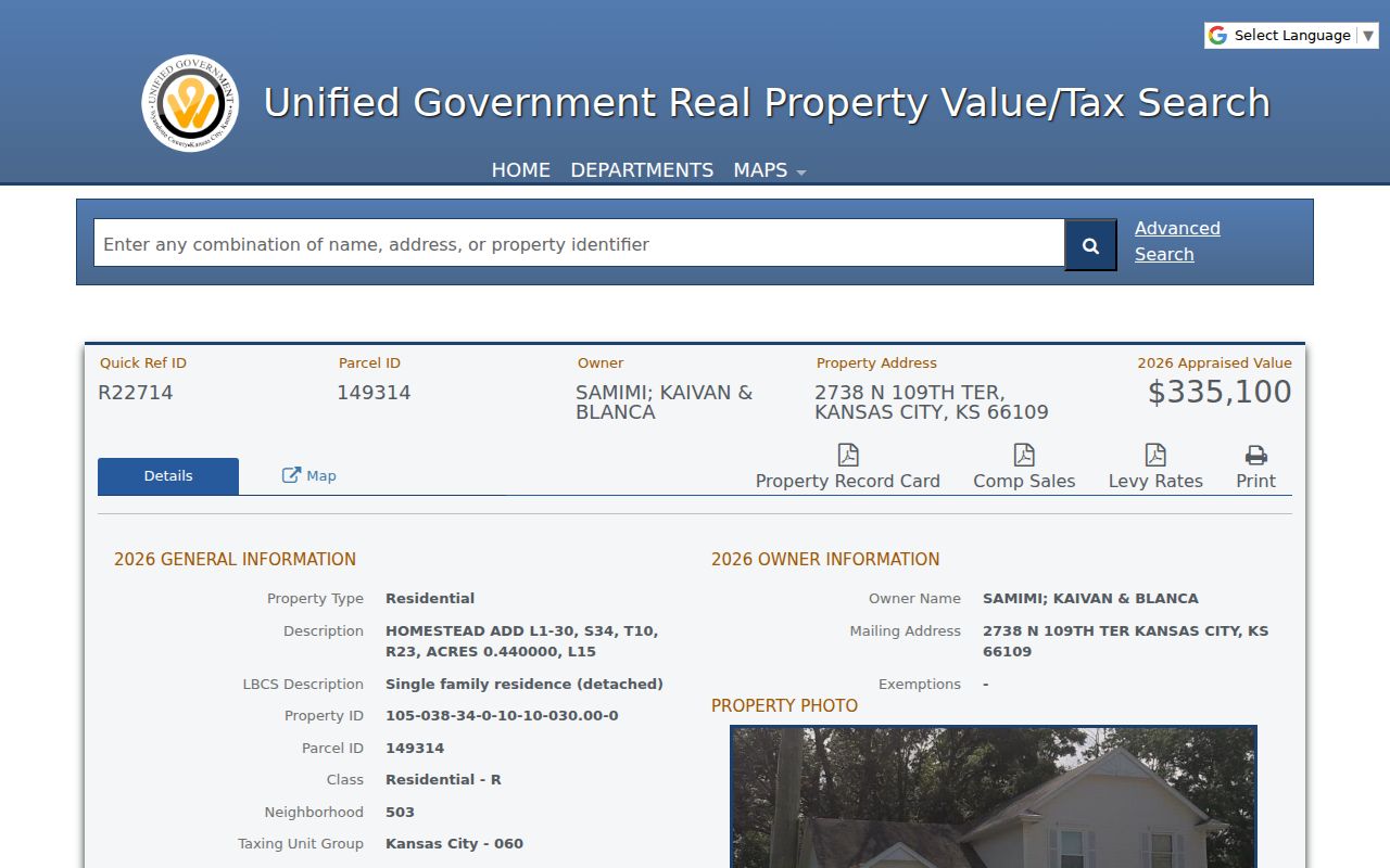
The card preserves parcel keys even if an owner label changes.
- Parcel
- A mapped tax unit, not a household.
- Situs address
- The property location, separate from mailing.
- Plat
- A recorded map of lots, blocks, or streets.
- Criss-cross directory
- A historical directory arranged by address or phone.
Kansas City Has Two Address Labels
Parcel R38998 shows the local mailing-versus-situs quirk. Its property is on South 50th Street while mail goes to South 49th Place. Preserve both labels. A tax office can send mail somewhere other than the parcel.
Compare the R38998 detail.
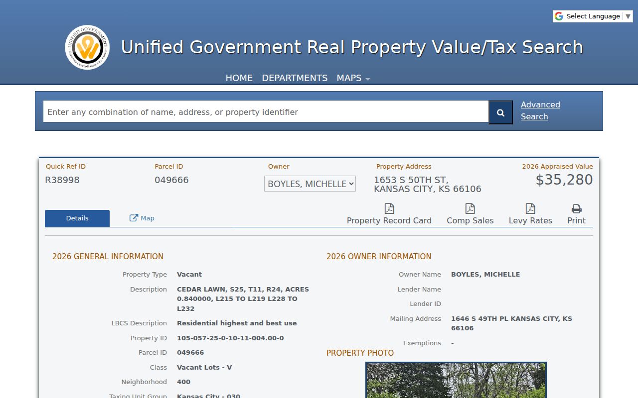
The screen shows why mailing data cannot become a residence claim.
Key point. Search legal description and book/page after the card; the owner label alone is not a deed or occupancy record.
Kansas City Records by Street
Address sources overlap, but none replaces another. Preserve each custodian and fallback.
| Record | Keeper | Output | Access |
|---|---|---|---|
| Tax card | Appraiser | Owner label, addresses, parcel, value | Portal or office |
| GIS | GSS | Approximate parcel, street, ZIP, neighborhood | Map Search, layers, map help |
| Instrument | Register of Deeds | Parties, legal description, dates | Counter, phone, KORA, microfilm |
| Postal | USPS | Delivery address and ZIP | Address lookup |
| Historic | KSHS, KCKPL, museum | Dated maps, names, news | Catalog, Kansas Room, microfilm |
No current remote grantor/grantee index was found. Use the recorder counter, phone, a narrow KORA request, or KSHS deed microfilm rather than inferring a deed from the assessor.
Map Kansas City Streets Precisely
The GSS Map Search accepts map type, Plat Name, Map Number, Section, Township, and Range for plat, parcel, and engineering maps.
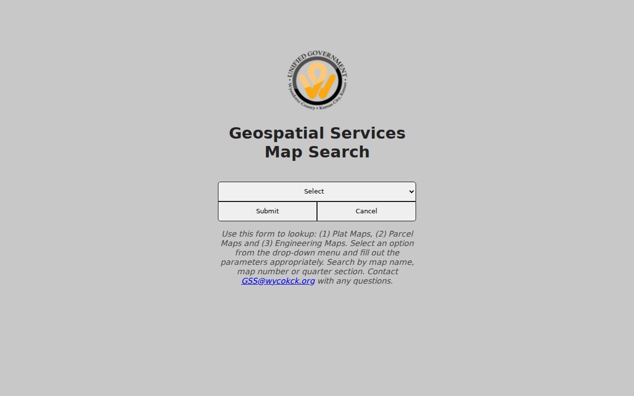
Quarter-section fields give a second route when an old street label fails.
The official parcel query offers text, geometry, field, count, sort, and paging controls.
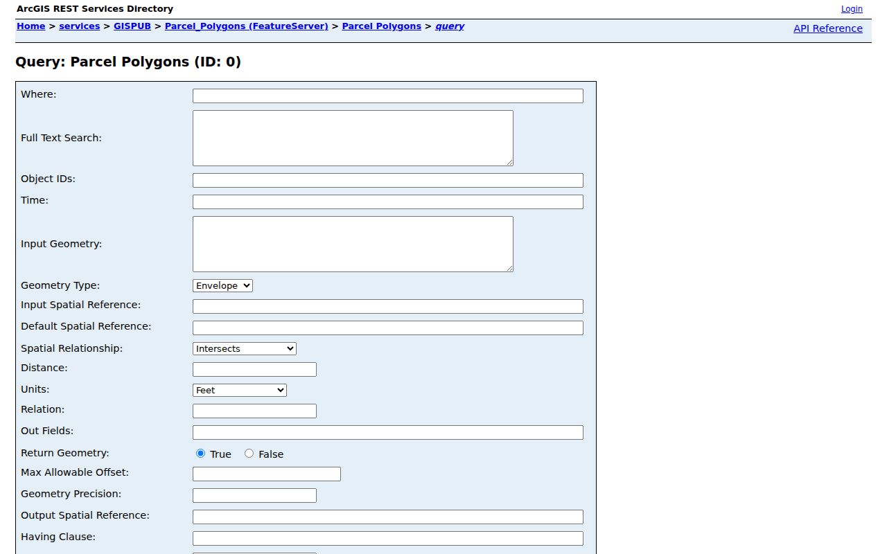
GIS boundaries are approximate. Use a plat, deed, or survey for a legal boundary.
Kansas City Streets Meet Deeds
The Register of Deeds at 710 N 7th Street, Suite 100, 913-573-2841, holds filed instruments. Carry legal description or book/page from the tax card to that office. KSHS holds Wyandotte deeds from 1859 through 1901 on microfilm, with chronological and grantor/grantee indexes.
A grantor transfers an interest; a grantee receives it. Capture instrument and filing dates, document type, parties, legal description, and book/page. A mortgage, release, easement, plat, correction, probate transfer, or foreclosure does not necessarily show an occupant or move. Label each record before drawing conclusions.
Note: If an image is not online, preserve the gap and use the recorder counter, phone, KORA, or historical microfilm.
Kansas City Streets Changed Names
Wyandotte City, Kansas City, Armourdale, Armstrong, and Riverview consolidated in 1886. Argentine joined in 1909 and Rosedale in 1922. Later annexations and the 1997 Unified Government changed the record geography again. Search predecessor names in KSHS catalogs, post-office records, newspapers, and maps.
Sanborn coverage for 1885, 1889, 1907, 1908, 1917, 1931, the 1950s, 1963, and 1968 supplies dated street context. Current parcel lines should not be projected backward without checking an old plat. The Kansas City directory collections can add a dated address entry after parcel work.
Kansas City Street Research Sheet
A reproducible street directory needs more than a list of names. Give each source its own dated row. Record the street exactly as displayed, including directional, suffix, unit, postal last line, and ZIP. Keep the situs address apart from the owner mailing address. Add the Quick Ref ID, parcel ID, legal description, subdivision, lot, block, book/page, map number, neighborhood, and taxing unit when the Appraiser supplies them. A blank field should remain blank instead of being filled from a different record.
Then note what kind of name appeared. An Appraiser owner label is a tax field. A grantor or grantee is a party to an instrument. A city-directory entry is a dated listing. A newspaper supplies the address only if its text states one. These labels are not interchangeable. Use a confidence column with four choices: confirmed when two strong sources share identifiers and dates, probable when one key field is missing, unresolved when records conflict, and gap when the needed image or index row cannot be inspected.
| Worksheet field | What to save |
|---|---|
| Address | Source spelling, unit, directional, city label, ZIP |
| Parcel | Quick Ref, parcel ID, legal description, lot and block |
| Person or entity | Exact label and the record role it represents |
| Date | Tax year, filing date, directory year, or query date |
| Proof and limit | Second source, conflict, missing image, or access restriction |
This format also makes changes visible. A new owner label in a later tax year is a new snapshot, not proof that an older card was wrong. A split or combined parcel may explain why the street sequence changes. Save the official URL or catalog call number with every row.
When Kansas City Addresses Fail
A no-result can have many causes. Remove apartment text, test both directional forms, and try the street without its suffix. Search by parcel or Quick Ref ID if one appears in an older note. The GSS Map Search gives another route through plat name, map number, section, township, and range. These fields are useful when an old source gives a subdivision or rural land description instead of a modern street number.
Historical work needs alternate place names. Search Wyandotte, Armourdale, Argentine, Rosedale, Quindaro, and Kansas City in the Kansas Historical Society catalog, KCKPL newspapers, post-office records, and Sanborn holdings. An old source may use a branch post office or former municipality even when the modern parcel is inside Kansas City. Do not change the historical wording in a citation. Record it, then explain how a plat, legal description, or dated map connects it to the present place.
Use every documented access channel before calling a gap final. Start with the Appraiser and GSS web tools. Call Geospatial Services at 913-573-2941 for map help. Take the legal description or book/page to the Register of Deeds counter or call 913-573-2841. For 1859 through 1901 deeds, request the indexed KSHS microfilm roll. KCKPL and the Wyandotte County Museum can supply directories, newspapers, maps, photographs, obituaries, and other dated context. A narrow KORA request can seek an existing county record that is not openly indexed.
Some gaps must remain. The official research did not locate a current public remote grantor/grantee index or an open image of an individual Kansas City directory entry. Cite the catalog or office route and state that the underlying row or image still needs inspection. That is more accurate than converting a parcel card, map label, or catalog description into evidence it does not contain.
When the issue is a postal conflict, verify the full address through the official USPS ZIP lookup and keep its result apart from the county map. A ZIP code routes mail; it does not define Kansas City boundaries. Compare that output with the GSS ZIP layer, property-address layer, and Appraiser card. If they disagree, note every label and query date. Hand the ZIP-level question to the Kansas City ZIP directory rather than forcing a postal answer into a parcel conclusion.
For an address that appears only in a dated directory, copy the volume title, year, publisher, page, and exact entry. Search the nearest earlier and later available years to bracket a move, but do not assume residence through a missing interval. KSHS catalog results can mix Kansas City, Kansas with Missouri holdings, so confirm Wyandotte County and the full title. KCKPL newspapers or yearbooks may corroborate a school, club, business, or dated event. The museum can check directories, telephone books, obituaries, maps, photographs, cemetery material, and probate holdings when the online trail ends.
Kansas City Property Alerts
A property alert is a prompt to inspect a filing, not proof of wrongdoing. Match any notice to the instrument number, filing date, legal description, and recorder record.
Review the Wyandotte Property Fraud Alert.
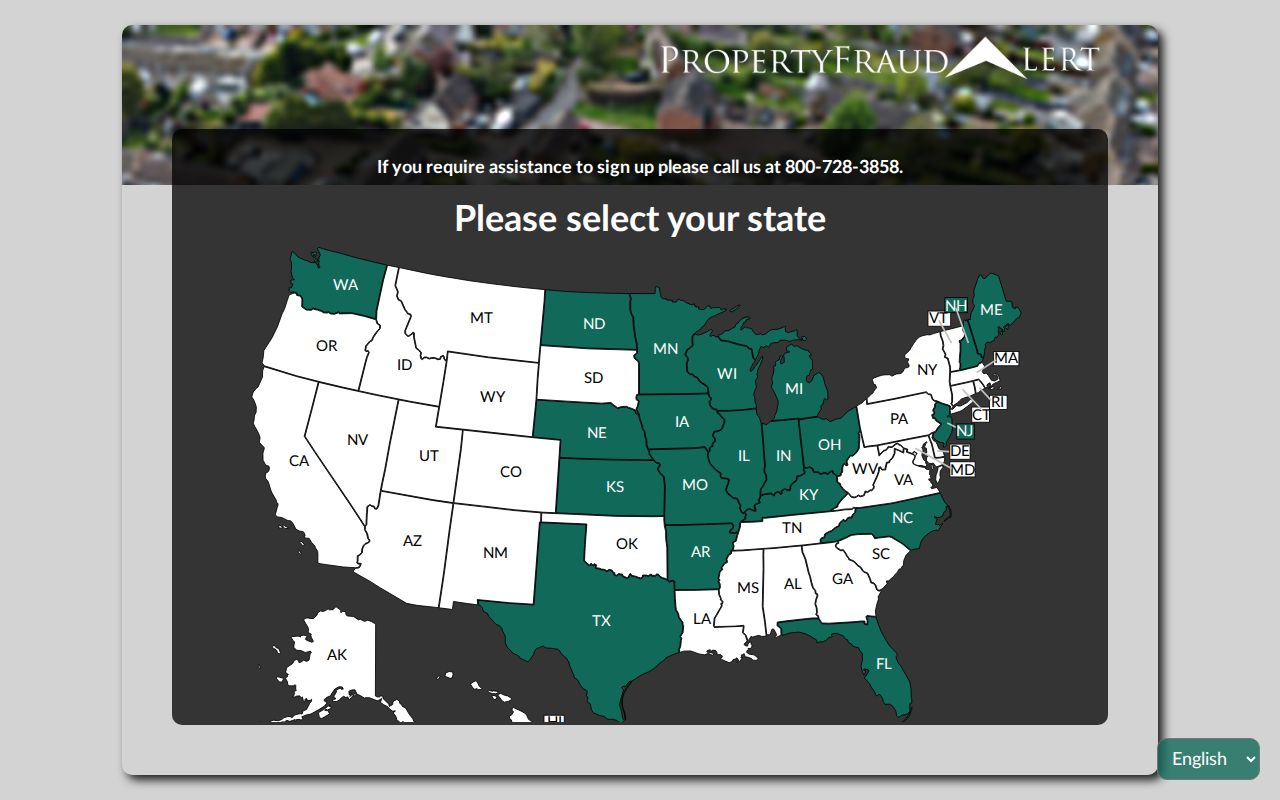
The service points users back to land records that still require verification.
Kansas City Street Directory Limits
Parcel records do not list every person in a home. An owner may live elsewhere, a dated directory may describe a past household, and VoterView is an individual election lookup rather than a public street roster. Protected addresses and restricted records stay protected.
A no-result does not prove an address never existed. Try no unit text, both directional forms, no suffix, parcel or map number, quarter section, and predecessor-city labels. Use the KORA portal only for a narrow request for an existing public record.
Lawful use. Use Kansas City address records for legitimate personal, historical, property, or civic research. Never use a street directory to stalk, harass, intimidate, or harm anyone.